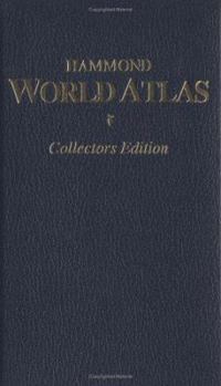
Hammond World Atlas
Select Format
Select Condition 
Book Overview
A spectacular new world atlas featuring: -252 pages of colorful world & U.S. maps -handy zip codes -valuable 5,000-entry Master Index A durable easy-to-use atlas with the world-renowned Hammond Name! This description may be from another edition of this product.
Format:Hardcover
Language:English
ISBN:0843716045
ISBN13:9780843716047
Release Date:January 1992
Publisher:Hammond World Atlas Corporation
Length:224 Pages
Weight:0.60 lbs.
Dimensions:0.9" x 4.4" x 6.8"
Customer Reviews
4 ratings
just what I wanted! a great altlas!
Published by Thriftbooks.com User , 22 years ago
This a great atlas. I got one for my own home to use with my kids. I was so impressed I got two more for gifts. My father in law loves it too...it's great for everyone! Wonderful detail and up to date. I highly recommend it! Quality atlas.
Number 1 World Atlas For Sheer Beauty
Published by Thriftbooks.com User , 22 years ago
I did quite a bit of research before purchasing my world atlas and the Hammond was the one I decided on. In the end I'm glad I did not assume pricier is better because while the Hammond is not cheap, it is less than half the price of the National Geographic! In regards to aesthetic beauty there is not another atlas to challenge it and you give up nothing in thoroughness. In fact it contains substantially more place names than the DK and Trident atlases, and only slightly less than the Times Concise. It contains roughly the same as the National Geographic. The wonderful relief shading and the height/depth color scheme are the deal closers. And finally, the printing job from Italy is top notch in regards to paper and construction. Trust me, this is the atlas to choose.
Beautifully crafted, admirable feat.
Published by Thriftbooks.com User , 23 years ago
Hammond was one of the first to commercially release a printed world atlas generated from digital databases. With the second edition of their Atlas of the World in 1998, they have released an impressive overview of our world at the end of the twentieth century. The coloring of the reference maps is one of the best I've seen so far, and includes shaded relief supplemented by layer coloring to indicate surface height. Most relief shading makes reference maps less legible, but here, the maps remain highly legible throughout. The reference maps provide a well-balanced coverage of the world with attention to the more populous areas on all continents. Since its origination is the U.S., there is a slight emphasis on North America, but not as much as often seen in other U.S.-originated world atlases. The index gazetteer contains some 102,000 names which is competitive for world atlases of this size. The thematic section is not large but does cover some of the most important thematic topics on our world. A few minor points are the lack of many important roads, and the combination of shaded relief and river courses: sometimes rivers seem to run right over various mountaintops. Also, coastlines are not always accurate enough, and especially in Asia, plates remain rather empty compared to its competitors. Still, these minor points do not spoil the fun at all, and this remains one of the best choices if you're looking for a good world atlas.
A World Atlas that is worth the money!
Published by Thriftbooks.com User , 24 years ago
I like very much to read maps. And this Atlas has stamina for it! The printing quality is excelent and the fine detail in the images is enjoyable. This atlas is an excellent reference source for families, executives, or travelers.The CD ROM included is a fantastic journey around the world though the PC. Is far easy to search any reference and go there on screen. The infomation is exact and easy to find and there is so much of it that you allways find something new in it.Why nor five stars? The binding makes the maps hard to read in the binding boundaries.


